
Ecosystem analysis
The IRD will carry out an analysis by satellite imagery of the state of coral reef habitats in order to evaluate their evolution over the last few decades and the role they may have played on erosion phenomena. A regional inventory of the state of reefs will lead to the creation of a regional database and a regional “Reefs” report, five years after the publication of the report “Status and trends of Caribbean oral Reefs”. This work is undertaken by the SPAW-RAC in collaboration with the GCRMN Caribbean (Global Coral Reef Monitoring Network) network of experts.
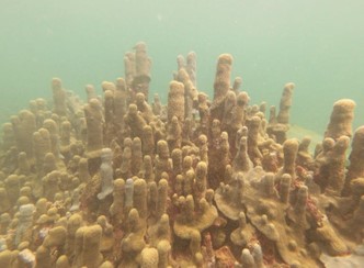
Reef Action
A bibliographical preparatory phase will be implemented to define one or more restoration actions on relevant territories in the light of the preliminary results concerning coral reefs. A training workshop on reef monitoring techniques established by the GCRMN-Caribbean will be organised in the continuity of similar workshops already set up by the SPAW-RAC. Various communication supports and actions will also be carried out during the project in order to disseminate knowledge on the coastal protection and regulation services provided by the Caribbean reefs.
Coral reef restoration pilot project (SPAW-RAC)
North-East (NE) Tobago is Trinidad & Tobago’s most iconic conservation landscape. It is a rare and largely intact ecosystem that includes the world’s oldest tropical rainforest reserve, one declared in 2019 (Tobago Main Ridge Forest Reserve) and two candidate Natural National Heritage (NNH) Sites, a multitude of proposed Cultural [...]