
Saint Martin : Installation of a coastal imaging device to monitor shoreline evolution
The INTERREG CARIBCOAST project has financed with the support of the French Coastal Conservatory the deployment of stand-alone cameras to study shoreline evolution of the south part of Orient Bay’s in Saint Martin, French West Indies. These scientific monitoring devices complete the installation of a wave-gauge off the Tintamarre islet, also financed within the framework of the CARIBCOAST project that will supply data to increase knowledge about coastal hazards in Saint-Martin Island.
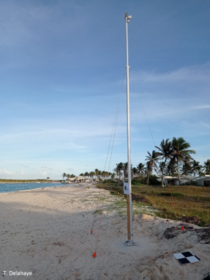
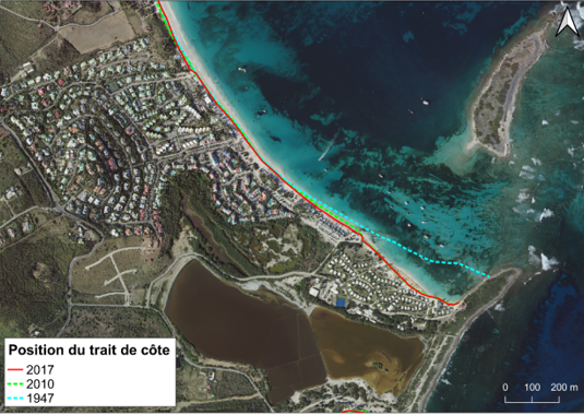
The implantation site, owned by Coastal Conservatory, is in southern part of the Orient Bay. It has been selected because it’s particulary exposed to coastal erosion. The retreat of the shoreline range from 50 to 150 m since the 1950s with extreme values at the eastern part of the beach. This shore is then most exposed area to coastal erosion on the French part of the island.
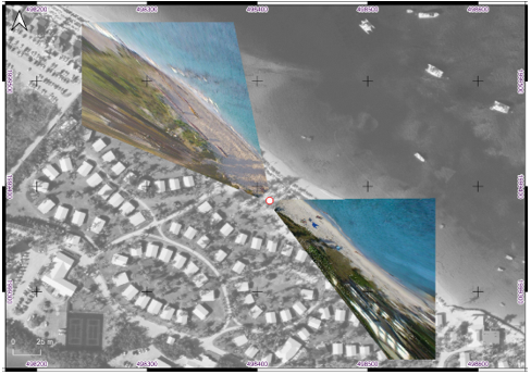
These innovative devices, already used in Guadeloupe and Martinique to monitor the coastline and sargassum strandings, acquire images at a regular time step (typically from a picture each 10 minutes to 1 hour). Then, the photos are automatically transmitted to the French Geological Survey (BRGM) where processing is performed to extract the shoreline position and study its evolution at high frequency (useful for describing seasonal cycles as for observing impacts linked to an extreme event). A calibration phase is required in order to convert oblic images to orthophotographies in geographical coordinates. Afterward, shoreline position may be digitalized on corrected images.
This monitoring system is fully in line with the objective of the CARIB-COAST project, which goal is to initiate a Caribbean network for the prevention and management of coastal risks related to climate change. It aims to improve knowledge about coastal processes involved in the evolution of this beach and thus help the French Coastal Conservatory in its management. This system will operate at least until the end of the project and may remain in place longer if the interest of such a monitoring is confirmed.